About the CoMSES Model Library more info
Our mission is to help computational modelers develop, document, and share their computational models in accordance with community standards and good open science and software engineering practices. Model authors can publish their model source code in the Computational Model Library with narrative documentation as well as metadata that supports open science and emerging norms that facilitate software citation, computational reproducibility / frictionless reuse, and interoperability. Model authors can also request private peer review of their computational models. Models that pass peer review receive a DOI once published.
All users of models published in the library must cite model authors when they use and benefit from their code.
Please check out our model publishing tutorial and feel free to contact us if you have any questions or concerns about publishing your model(s) in the Computational Model Library.
We also maintain a curated database of over 7500 publications of agent-based and individual based models with detailed metadata on availability of code and bibliometric information on the landscape of ABM/IBM publications that we welcome you to explore.
Displaying 10 of 1110 results for "Oto Hudec" clear search
Bid-rigging Norms Game Model
HIDEYUKI MOROFUJI | Published Tuesday, July 27, 2021 | Last modified Friday, May 12, 2023In this simulation, we modify the norms game model to bid-rigging (collusion) model, while we can simulate also the norms game model.
Decision Models for Generalized Price's Equation and Companion Code
Victor Sahin | Published Tuesday, July 02, 2019This is a series of simulations of binary group decisions and the outcomes applied to a generalized version of Price’s Equation for system fitness.
Peer reviewed INOvCWD
Aniruddha Belsare | Published Wednesday, June 01, 2022 | Last modified Wednesday, July 10, 2024INOvCWD is a spatially-explicit, agent-based model designed to simulate the spread of chronic wasting disease (CWD) in Indiana’s white-tailed deer populations.
Peer reviewed Organizational behavior in the hierarchy model
Smarzhevskiy Ivan | Published Tuesday, June 18, 2019 | Last modified Wednesday, July 31, 2019In a two-level hierarchical structure (consisting of the positions of managers and operators), persons holding these positions have a certain performance and the value of their own (personal perception in this, simplified, version of the model) perception of each other. The value of the perception of each other by agents is defined as a random variable that has a normal distribution (distribution parameters are set by the control elements of the interface).
In the world of the model, which is the space of perceptions, agents implement two strategies: rapprochement with agents that perceive positively and distance from agents that perceive negatively (both can be implemented, one of these strategies, or neither, the other strategy, which makes the agent stationary). Strategies are implemented in relation to those agents that are in the radius of perception (PerRadius).
The manager (Head) forms a team of agents. The performance of the group (the sum of the individual productivities of subordinates, weighted by the distance from the leader) varies depending on the position of the agents in space and the values of their individual productivities. Individual productivities, in the current version of the model, are set as a random variable distributed evenly on a numerical segment from 0 to 100. The manager forms the team 1) from agents that are in (organizational) radius (Op_Radius), 2) among agents that the manager perceives positively and / or negatively (both can be implemented, one of the specified rules, or neither, which means the refusal of the command formation).
Agents can (with a certain probability, given by the variable PrbltyOfDecisn%), in case of a negative perception of the manager, leave his group permanently.
It is possible in the model to change on the fly radii values, update the perception value across the entire population and the perception of an individual agent by its neighbors within the perception radius, and the probability values for a subordinate to make a decision about leaving the group.
You can also change the set of strategies for moving agents and strategies for recruiting a team manager. It is possible to add a randomness factor to the movement of agents (Stoch_Motion_Speed, the default is set to 0, that is, there are no random movements).
…
BN intervention model
Di Wang | Published Wednesday, July 13, 2011 | Last modified Saturday, April 27, 2013Bayesian network is used to modelling the behavior of an individual level and multi-agent system is used to simulate the meme diffusion through the whole network.
A-KinGDom: A Kinship, Grooming and Dominance Model for Primate Societies
Ruth Dolado Francesc S Beltran Vicenc Quera | Published Thursday, July 11, 2013 | Last modified Wednesday, July 17, 2013A-KinGDom simulates the emergence of the social structure in a group of non-human primates. The model includes dominance and affiliative interactions which allow us to define four different attack and affiliative strategies.
Investor-based electricity market model
Oscar Kraan | Published Monday, January 02, 2017 | Last modified Friday, October 12, 2018The model is a representation of a liberalised electricity market designed as an energy-only market and consists of large scale investors and their power generation assets in the electricity market.
Demand Planning Model
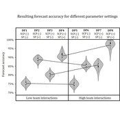
Iris Lorscheid Jonas Hauke Matthias Meyer | Published Wednesday, October 04, 2017Demand planning requires processing of distributed information. In this process, individuals, their properties and interactions play a crucial role. This model is a computational testbed to investigate these aspects with respect to forecast accuracy.
Transport simulation in a real road network
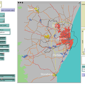
Gary Polhill Jiaqi Ge | Published Tuesday, April 17, 2018 | Last modified Tuesday, April 17, 2018Ge, J., & Polhill, G. (2016). Exploring the Combined Impact of Factors Influencing Commuting Patterns and CO2 Emission in Aberdeen Using an Agent-Based Model. Journal of Artificial Societies and Social Simulation, 19(3). http://jasss.soc.surrey.ac.uk/19/3/11.html
We develop an agent-based transport model using a realistic GIS-enabled road network and the car following method. The model can be used to study the impact of social interventions such as flexi-time and workplace sharing, as well as large infrastructure such as the construction of a bypass or highway. The model is developed in Netlogo version 5 and requires road network data in GIS format to run.
The Regional Security Game: An Agent-based, Evolutionary Model of Strategic Evolution and Stability
Anthony Skews | Published Saturday, June 09, 2018The Regional Security Game is a iterated public goods game with punishement based on based on life sciences work by Boyd et al. (2003 ) and Hintze & Adami (2015 ), with modifications appropriate for an international relations setting. The game models a closed regional system in which states compete over the distribution of common security benefits. Drawing on recent work applying cultural evolutionary paradigms in the social sciences, states learn through imitation of successful strategies rather than making instrumentally rational choices. The model includes the option to fit empirical data to the model, with two case studies included: Europe in 1933 on the verge of war and south-east Asia in 2013.
Displaying 10 of 1110 results for "Oto Hudec" clear search
