Our mission is to help computational modelers develop, document, and share their computational models in accordance with community standards and good open science and software engineering practices. Model authors can publish their model source code in the Computational Model Library with narrative documentation as well as metadata that supports open science and emerging norms that facilitate software citation, computational reproducibility / frictionless reuse, and interoperability. Model authors can also request private peer review of their computational models. Models that pass peer review receive a DOI once published.
All users of models published in the library must cite model authors when they use and benefit from their code.
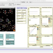
Please check out our model publishing tutorial and feel free to contact us if you have any questions or concerns about publishing your model(s) in the Computational Model Library.
Displaying 10 of 1143 results for "Sjoukje A Osinga" clear search
The Pampas Model: An agent-based model of agricultural systems in the Argentinean Pampas
Michael North Federico Bert Guillermo P Podestá Santiago L Rovere Charles Macal | Published Tuesday, July 16, 2013 | Last modified Tuesday, February 17, 2015The Pampas Model is an Agent-Based Model intended to explore the dynamics of structural and land use changes in agricultural systems of the Argentine Pampas in response to climatic, technological economic, and political drivers.
An agent-based model for assessing strategies of adaptation to climate and tourism demand changes in an alpine destination
Stefano Balbi Marco Alberti | Published Monday, February 14, 2011 | Last modified Saturday, April 27, 2013The model is then used for assessing three hypothetical and contrasted infrastructure-oriented adaptation strategies for the winter tourism industry, that have been previously discussed with local stakeholders, as possible alternatives to the “business-as-usual” situation.
SMILI: Small-scale fisheries Institutions and Local Interactions
Emilie Lindkvist Maja Schlüter Xavier Basurto | Published Thursday, March 09, 2017The model represents an archetypical fishery in a co-evolutionary social-ecological environment, capturing different dimensions of trust between fishers and fish buyers for the establishment and persistence of self-governance arrangements.
Diffusion of Eco-Innovation through Inter-firm Network Targeting: An Agent-Based Model
apyka Flaminio Squazzoni Shyaam Ramkumar Matthias Mueller | Published Monday, January 10, 2022This model is developed as a theoretical agent-based model to study the general phenomena of network-based targeting strategies on eco-innovation adoption and diffusion through inter-firm networks.
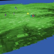
This model presents an autonomous, two-lane driving environment with a single lane-closure that can be toggled. The four driving scenarios - two baseline cases (based on the real-world) and two experimental setups - are as follows:
- Baseline-1 is where cars are not informed of the lane closure.
- Baseline-2 is where a Red Zone is marked wherein cars are informed of the lane closure ahead.
- Strategy-1 is where cars use a co-operative driving strategy - FAS. <sup>[1]</sup>
- Strategy-2 is a variant of Strategy-1 and uses comfortable deceleration values instead of the vehicle’s limit.
…
A model of the emergence of intersectional life course inequalities through transitions in the workplace. It explores LGBTQ citizens’ career outcomes and trajectories in relation to several mediating factors: (i) workplace discrimination; (ii) social capital; (iii) policy interventions (i.e., workplace equality, diversity, and inclusion policies); (iv) and LGBTQ employees’ behaviours in response to discrimination (i.e., moving workplaces and/or different strategies for managing the visibility of their identity).
An age and/or gender-based division of labor during the Last Glacial Maximum in Iberia through rabbit hunting
Liliana Perez Samuel Seuru Ariane Burke | Published Thursday, February 29, 2024Many archaeological assemblages from the Iberian Peninsula dated to the Last Glacial Maximum contain large quantities of European rabbit (Oryctolagus cuniculus) remains with an anthropic origin. Ethnographic and historic studies report that rabbits may be mass-collected through warren-based harvesting involving the collaborative participation of several persons.
We propose and implement an Agent-Based Model grounded in the Optimal Foraging Theory and the Diet Breadth Model to examine how different warren-based hunting strategies influence the resulting human diets.
…
Peer reviewed Ache hunting
Kim Hill Marco Janssen | Published Tuesday, August 13, 2013 | Last modified Friday, December 21, 2018Agent-based model of hunting behavior of Ache hunter-gatherers from Paraguay. We evaluate the effect of group size and cooperative hunting
FilterBubbles_in_Carley1991
Benoît Desmarchelier | Published Wednesday, May 21, 2025The model is an extension of: Carley K. (1991) “A theory of group stability”, American Sociological Review, vol. 56, pp. 331-354.
The original model from Carley (1991) works as follows:
- Agents know or ignore a series of knowledge facts;
- At each time step, each agent i choose a partner j to interact with at random, with a probability of choice proportional to the degree of knowledge facts they have in common.
- Agents interact synchronously. As such, interaction happens only if the partnert j is not already busy interacting with someone else.
…
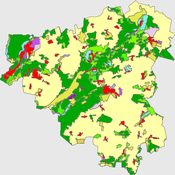
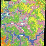
Peer reviewed The Viability of the Social-Ecological Agroecosystem (ViSA) Spatial Agent-based Model
Mostafa Shaaban | Published Friday, June 03, 2022ViSA simulates the decision behaviors of different stakeholders showing demands for ecosystem services (ESS) in agricultural landscape. The lack of sufficient supply of ESSs triggers stakeholders to apply different management options to increase their supply. However, while attempting to reduce the supply-demand gap, conflicts arise among stakeholders due to the tradeoff nature of some ESS. ViSA investigates conditions and scenarios that can minimize such supply-demand gap while reducing the risk of conflicts by suggesting different mixes of management options and decision rules.
Displaying 10 of 1143 results for "Sjoukje A Osinga" clear search