Our mission is to help computational modelers develop, document, and share their computational models in accordance with community standards and good open science and software engineering practices. Model authors can publish their model source code in the Computational Model Library with narrative documentation as well as metadata that supports open science and emerging norms that facilitate software citation, computational reproducibility / frictionless reuse, and interoperability. Model authors can also request private peer review of their computational models. Models that pass peer review receive a DOI once published.
All users of models published in the library must cite model authors when they use and benefit from their code.
Please check out our model publishing tutorial and feel free to contact us if you have any questions or concerns about publishing your model(s) in the Computational Model Library.
Displaying 10 of 49 results location clear search
A Simple Agent Based Modeling Tool for Plastic and Debris Tracking in Oceans
Subu Kandaswamy Koushik Sura Bhaskar Sai Amulya Murukutla Sai Pranay Raju Chinthala Abhishek Bobbillapati | Published Monday, October 04, 2021Plastics and the pollution caused by their waste have always been a menace to both nature and humans. With the continual increase in plastic waste, the contamination due to plastic has stretched to the oceans. Many plastics are being drained into the oceans and rose to accumulate in the oceans. These plastics have seemed to form large patches of debris that keep floating in the oceans over the years. Identification of the plastic debris in the ocean is challenging and it is essential to clean plastic debris from the ocean. We propose a simple tool built using the agent-based modeling framework NetLogo. The tool uses ocean currents data and plastic data both being loaded using GIS (Geographic Information System) to simulate and visualize the movement of floatable plastic and debris in the oceans. The tool can be used to identify the plastic debris that has been piled up in the oceans. The tool can also be used as a teaching aid in classrooms to bring awareness about the impact of plastic pollution. This tool could additionally assist people to realize how a small plastic chunk discarded can end up as large debris drifting in the oceans. The same tool might help us narrow down the search area while looking out for missing cargo and wreckage parts of ships or flights. Though the tool does not pinpoint the location, it might help in reducing the search area and might be a rudimentary alternative for more computationally expensive models.
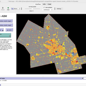
Armature distribution within the PaleoscapeABM
Claudine Gravel-Miguel | Published Tuesday, March 23, 2021This is a variant of the PaleoscapeABM model available here written by Wren and Janssen. In this variant, we give projectile weapons to hunter and document where they discard them over time. Discard rate and location are influenced by probabilities of hitting/missing the prey, probabilities of damaging the weapon, and probabilities of carrying back embedded projectile armatures to the habitation camp with the body carcass.
FeedUS - A global food trade model
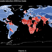
Jiaqi Ge | Published Thursday, February 25, 2021 | Last modified Friday, February 26, 2021The purpose of the model is to study the impact of global food trade on food and nutrition security in countries around the world. It will incorporate three main aspects of trade between countries, including a country’s wealth, geographic location, and its trade relationships with other countries (past and ongoing), and can be used to study food and nutrition security across countries in various scenarios, such as climate change, sustainable intensification, waste reduction and dietary change.
TunaFisher ABM
Guus Ten Broeke | Published Wednesday, January 13, 2021TunaFisher ABM simulates the decisions of fishing companies and fishing vessels of the Philippine tuna purse seinery operating in the Celebes and Sulu Seas.
High fishing effort remains in many of the world’s fisheries, including the Philippine tuna purse seinery, despite a variety of policies that have been implemented to reduce it. These policies have predominantly focused on models of cause and effect which ignore the possibility that the intended outcomes are altered by social behavior of autonomous agents at lower scales.
This model is a spatially explicit Agent-based Model (ABM) for the Philippine tuna purse seine fishery, specifically designed to include social behavior and to study its effects on fishing effort, fish stock and industry profit. The model includes economic and social factors of decision making by companies and fishing vessels that have been informed by interviews.
…
Retail Competition Agent-based Model
Derek Robinson Jiaxin Zhang | Published Sunday, January 03, 2021 | Last modified Wednesday, November 10, 2021The Retail Competition Agent-based Model (RC-ABM) is designed to simulate the retail competition system in the Region of Waterloo, Ontario, Canada, which which explicitly represents store competition behaviour. Through the RC-ABM, we aim to answer 4 research questions: 1) What is the level of correspondence between market share and revenue acquisition for an agent-based approach compared to a traditional location-allocation-based approach? 2) To what degree can the observed store spatial pattern be reproduced by competition? 3) To what degree are their path dependent patterns of retail success? 4) What is the relationship between retail survival and the endogenous geographic characteristics of stores and consumer expenditures?
Venues and Segregation: A Revised Schelling Model
Ultan Byrne | Published Thursday, August 06, 2020This model examines an important but underappreciated mechanism affecting urban segregation and integration: urban venues. The venue- an area where urbanites interact- is an essential aspect of city life that tends to influence how satisfactory any location is. We study the venue/segregation relationship by installing venues into Schelling’s classic agent-based segregation model.
The Coevolution of the Firm and the Product Attribute Space
César García-Díaz | Published Friday, May 22, 2020This model inspects the performance of firms as the product attribute space changes, which evolves as a consequence of firms’ actions. Firms may create new product variants by dragging demand from other existing variants. Firms decide whether to open new product variants, to invade existing ones, or to keep their variant portfolio. At each variant there is a Cournot competition each round. Competition is nested since many firms compete at many variants simultaneously, affecting firm composition at each location (variant).
After the Cournot outcomes, at each round firms decide whether to (i) keep their existing product variant niche, (ii) invade an existing variant, (iii) create a new variant, or (iv) abandon a variant. Firms’ profits across their niche take into consideration the niche-width cost and the cost of opening a new variant.
Eco-Evolutionary Pathways Toward Industrial Cities
Handi Chandra Putra | Published Thursday, May 21, 2020Industrial location theory has not emphasized environmental concerns, and research on industrial symbiosis has not emphasized workforce housing concerns. This article brings jobs, housing, and environmental considerations together in an agent-based model of industrial
and household location. It shows that four classic outcomes emerge from the interplay of a relatively small number of explanatory factors: the isolated enterprise with commuters; the company town; the economic agglomeration; and the balanced city.
Hybrid Agent-Based and Equation Based Model for Infectious Disease Spread
Elizabeth Hunter Brian Mac Namee John Kelleher | Published Sunday, April 19, 2020Our model is hybrid agent-based and equation based model for human air-borne infectious diseases measles. It follows an SEIR (susceptible, exposed,infected, and recovered) type compartmental model with the agents moving be-tween the four state relating to infectiousness. However, the disease model canswitch back and forth between agent-based and equation based depending onthe number of infected agents. Our society model is specific using the datato create a realistic synthetic population for a county in Ireland. The modelincludes transportation with agents moving between their current location anddesired destination using predetermined destinations or destinations selectedusing a gravity model.
Geographic Expansion Model (GEM)
Sean Bergin | Published Friday, February 28, 2020The purpose of this model is to explore the importance of geographic factors to the settlement choices of early Neolithic agriculturalists. In the model, each agriculturalist spreads to one of the best locations within a modeler specified radius. The best location is determined by choosing either one factor such as elevation or slope; or by ranking geographic factors in order of importance.
Displaying 10 of 49 results location clear search